
Geospatial Machine Learning Algorithms and Models
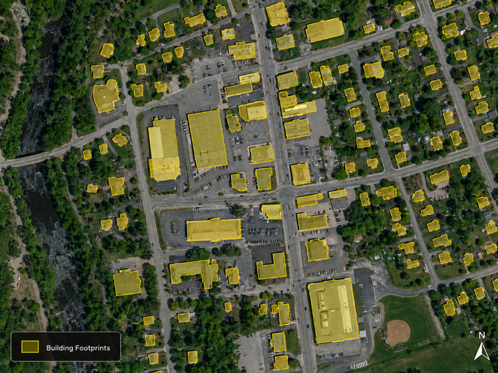
Optimized deep convolutional neural network models to extract building footprint polygons by incorporating location based features
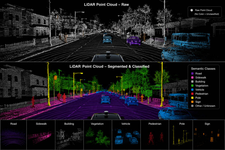
Vehicle mounted LiDAR data segmentation and classification – Road surface, Sidewalk, Vehicle, etc.
Maps
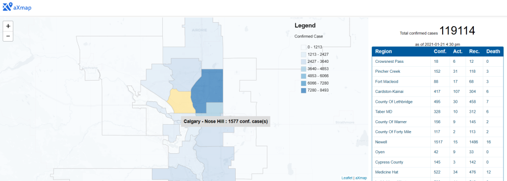
Interactive Map Lite – Covid-19 Map