
i.
Science
Rigorous spatial analysis and research-grade machine learning, built for your data rather than borrowed from someone else’s.

Geospatial solutions · Calgary, Alberta
Empowering the industry through the most advanced and inspiring geospatial innovations, from spatial analytics and GIS integration to LiDAR and custom machine learning.
01 Who we are
AXMAP brings together a team of researchers and developers with over 20 years of combined experience in geospatial science and engineering.
We started in 2007 as a series of a(x)map project ideas, driven by a fascination with how maps shape our understanding of place. In 2020 we incorporated in Alberta, Canada, on a simple belief: digital maps can transform the way people live and interact with their environment.
Today we deliver full-stack geospatial solutions for industries that run on spatial data. Our mission is to give clients the expertise and tools to gain deep location intelligence and to make better decisions because of it.
i.
Rigorous spatial analysis and research-grade machine learning, built for your data rather than borrowed from someone else’s.
ii.
Full-stack engineering, from data pipelines and models to GIS integration and the web maps your team uses every day.
iii.
Cartography and visualization that make complex geography legible at a glance, because a map nobody reads makes no decisions.
02 Services
L01
Uncover patterns. Visualize relationships. Drive decisions.
We transform complex geographic data into actionable business intelligence. Advanced spatial analysis and dynamic mapping reveal the patterns hidden in your data, so you can make decisions grounded in where things happen.
L02
Tailored geospatial solutions. Built for the future.
Our team specializes in Geographic Information Systems (GIS) design, implementation and integration. We build scalable tools that fit your operational needs instead of forcing your operations to fit the software.
L03
Strategic roadmaps for geospatial success.
Forward-thinking organizations need a clear roadmap. We help you plan and execute a geospatial strategy aligned with your organizational goals, with the return on investment in view from day one.
L04
Bringing your geospatial innovations to market.
We provide the market expertise, strategic positioning and launch frameworks to take geospatial technology from prototype to product, and to scale it across the North American market.
L05
Custom machine learning tailored to your data.
Generic algorithms yield generic results. We design, train and deploy geospatial machine-learning models for your specific datasets, from aerial imagery to LiDAR point clouds.
Our mission
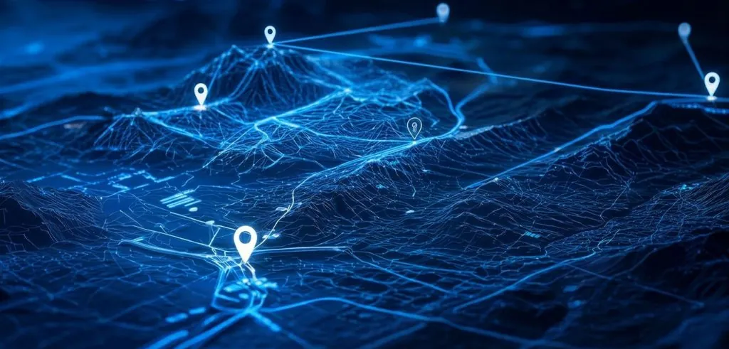
Equip every client with the expertise and tools to gain deep location intelligence.
03 Portfolio
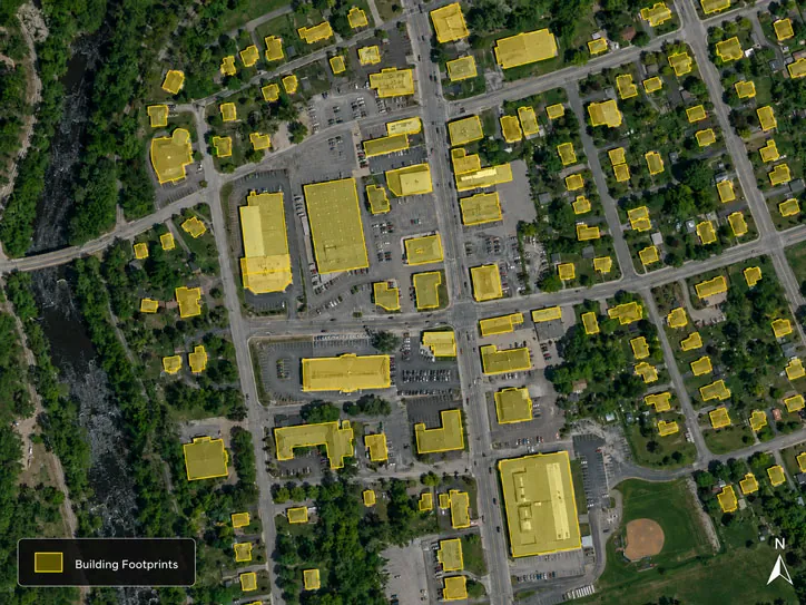
Optimized deep convolutional neural network models that extract building footprint polygons from aerial imagery, with accuracy improved by incorporating location-based features.
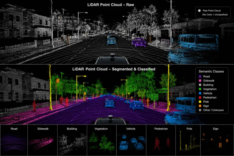
Segmentation and classification of vehicle-mounted LiDAR data into semantic classes such as road surface, sidewalk, building, vegetation, vehicle and pedestrian.
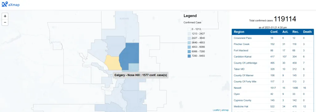
A lightweight interactive map of confirmed COVID-19 cases across Alberta’s regions, pairing a choropleth view with a live regional table of confirmed, active and recovered cases.
04 Contact
Tell us about your data, your question, or the product you want to bring to market. We’ll reply with how we’d approach it.